By: Emily Whalen
You’re in luck: peak fall color time in the Pocono Mountains is in a few weeks! Trust us, you’ll want to see this up close. From meandering to challenging, we’ve got just the right hike for you to view the astounding foliage this season.
The famed Appalachian Trail marks the southern border of the Poconos, and a plethora of varied trail systems throughout the region lead to waterfalls, spectacular views and quiet woodland walks surrounded by beautiful plant and wildlife. A trek in the Pocono Mountains can take the form of a restful and leisurely stroll, an educational experience or rigorous exercise. Wander through old growth forests, wetlands and rocky outcrops in our national, state and local parks.
Ready to hit the trails? Read on for six of the top hikes in the Pocono Mountains! We’ve got all the tips and information you need to know, from distance and difficulty to scenic highlights and pet-friendliness.
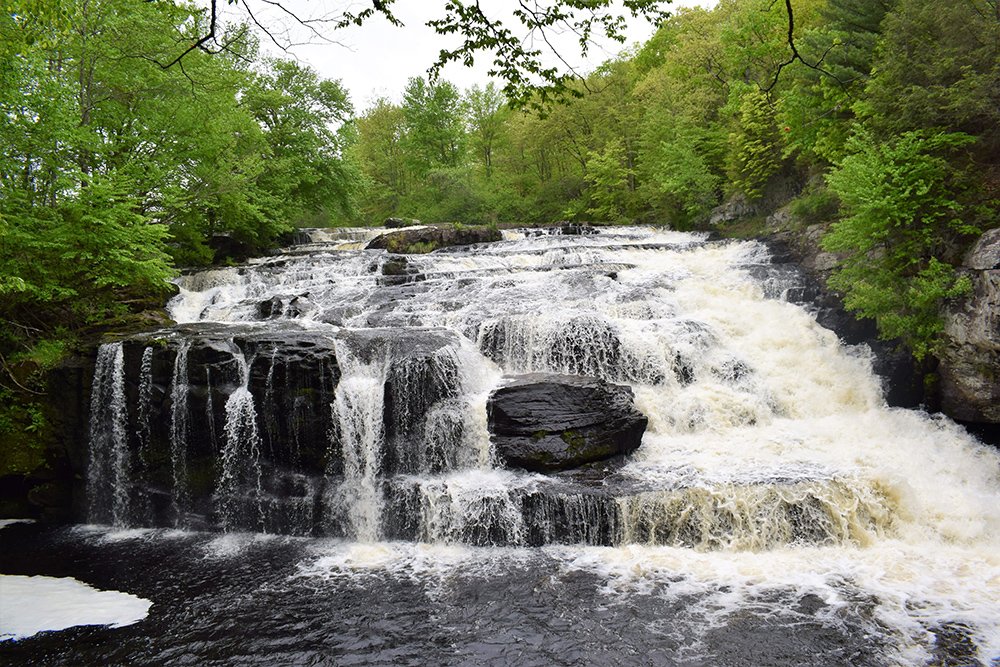
- Shohola Falls Trail
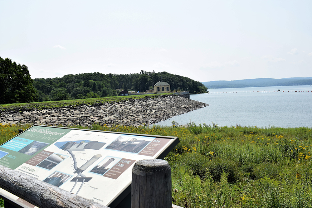
- Wallenpaupack Lake Trail
- McDade Recreational Trail
- Irving Cliff Trail
- Lehigh Gorge Trail
- Mount Minsi via Appalachian Trail

- Shohola Falls Trail
Location: Route 6 in Shohola, PA
Distance: 0.6 miles round-trip
Terrain: Slick, rocky creekside
Difficulty: Easy
Approved Uses: Hiking
Scenery: Shohola Falls, woods, creek
Pet Friendly: Yes
Our Take: Looking for a quick hike with gorgeous scenery? You’ll find it here! This short trail parallels the waterfall on a declining rock path. If the falls are running with ample water, the excess water splashes the trail making it slippery, so watch your step. This hike brings you head-on to the falls, so don’t forget to bring the camera for a photo-op. The trailhead can be difficult to see from the road; slow down as you approach the location so as not to miss the entrance.
Our Advice: Use caution when navigating the rocks as you walk down to the waterfall.
- Wallenpaupack Lake Trail
Location: Hawley, PA at the intersection of Routes 6 and 507
Distance: 3 miles round-trip
Terrain: Packed gravel
Difficulty: Easy
Approved Uses: Walking, trail running and nature trips
Scenery: Lake Wallenpaupack, woods, wildlife
Pet Friendly: No
Our Take: Whether you choose to do half or all of this trail, it’s a great, gentle option for those who prefer a leisurely walk. The path around Lake Wallenpaupack features beautiful contrasting colors: cool lake blues and warm autumnal reds, oranges and yellows.
Our Advice: Visit the Lake Wallenpaupack Visitors Center in Hawley for more information about the trail and surrounding area.
- McDade Recreational Trail
Location: Runs parallel to the Delaware River from Milford to Shawnee on Delaware
Distance: 31 miles with access points every few miles
Terrain: Packed gravel with some sturdy bridges and a few steep hills
Difficulty: Easy to moderate
Approved Uses: Hiking and biking
Scenery: Delaware River, farm fields, woods, historic buildings
Pet Friendly: Yes
Our Take: The McDade Recreational Trail is ideal for leisure seekers. Access points every few miles permit easy on/off/turn-arounds. Bordered by the Delaware River on one side and trees and farm fields on the other, the trail is well maintained and clearly marked. Smithfield Beach is a picturesque place to stop and take in views of foliage along the river.
Our Advice: Map your route in advance. Grab trail maps and information at a National Park Service Visitors Center.
- Irving Cliff Trail
Location: Honesdale, PA
Distance: 1 mile round-trip
Terrain: Gravel and dirt
Difficulty: Easy to moderate
Approved Uses: Hiking and trail running
Scenery: Downtown Honesdale, wild flowers
Pet Friendly: Yes
Our Take: When Washington Irving, author of classics like “The Legend of Sleepy Hollow,” visited Honesdale in 1841, he was so eager to drag his friends up the hill to get a better view of the town, they named the hike after him! The route leading to the summit is uphill but relatively short, smooth and sweet. The path isn’t challenging, and the views of Honesdale nestled in the surrounding hills are breathtaking, especially during the autumn.
Our Advice: Don’t forget your camera to capture the panoramic fall small town view from the top.
- Lehigh Gorge Trail
Location: Lehigh Gorge State Park in Jim Thorpe, PA
Distance: 26 miles with access points throughout the trail
Terrain: Packed gravel with boardwalks and bridges
Difficulty: Moderate
Approved Uses: Hiking and biking
Scenery: Thick vegetation, the Pocono Plateau, Lehigh Gorge and the Lehigh River
Pet Friendly: Yes
Our Take: As part of the Delaware & Lehigh National Scenic Corridor, this trek has some of the most beautiful views in the region. The trail can be completed in its entirety or picked up at different access points to shorten the trip. The park has ample parking in multiple lots and well-maintained walkways with benches. Within easy distance of Jim Thorpe, this is a great trail for families, couples and groups.
Our Advice: Start at the Rockport access point and walk towards Jim Thorpe. The 15-mile downgrade makes for a nice, relaxing walk.
For safety reasons, the Glen Onoko Falls Trail is closed to hikers as of May 1, 2019.
- Mount Minsi via Appalachian Trail
Location: Delaware Water Gap, PA
Distance: 5 miles round-trip
Terrain: Gravel and rocky
Difficulty: Challenging
Approved Uses: Hiking
Scenery: Forest paths, panoramic views of Mount Tammany, Kittatinny Ridge and the Delaware River
Pet Friendly: Yes (must be kept on leash)
Our Take: Set out from the historic borough of Delaware Water Gap and follow the white blazes of the Appalachian Trail up into the mountains. Choose from two routes: follow the bends of the river and stop at scenic overlooks or take the fire road up. When you reach the top, you’ll see panoramic views of Mount Tammany across the Gap.
Our Advice: Arrive early to claim a parking spot, especially on weekends. Don’t forget sturdy shoes and plenty of water.
All the trails featured in this blog are free! For more ideas, check out other hiking trails in the area. While vacationing in the Poconos, remember to visit responsibly. Please be respectful when experiencing our public spaces, and take your trash with you to leave no trace.
We hope these guides inspire you to hit the trails before the leaves hit the ground. Find a place to stay so you can rest up before completing all six of these hikes, and save on your stay with fall offers. For weekly updates on the leaves, check out our fall foliage forecast to get the most out of autumn in the Pocono Mountains.
(Pocono Mountains Blog)
Emily Whalen is the Communications Manager for the Pocono Mountains Visitors Bureau. A small town coffee shop connoisseur and lifelong lover of the mountains, she is excited to share tips to help visitors make the most of their stay in the Poconos.


